Last year, I began using Jon Corippo‘s 8 p*ARTS . I saw great success with the repetition. As a result, I thought I’d like to do something along similar lines with Math. Now, I will admit, what I came up with isn’t nearly as fun. However, the repetition is there. This is for 5th grade and can easily be modified for other grades. Here’s what I came up with.
The plan:
- Today’s Number – Have the student of the day decide on the day’s number anywhere from billion to thousandths place. However, the number must be at least to the tenths place.
- 10 times greater – Take the original number and make it ten times greater.
- 100 times greater – Take the original number and make it one hundred times greater.
- 1,000 times greater – Yup, take the original number and make it one thousand times greater.
- Add 10 times greater and 100 times greater – add the numbers.
- Write a number that is GREATER – Have students change ONLY a digit that is AFTER the decimal.
- 1/10 times less – Take the original number and make it ten times less.
- 1/100 times less – Take the original number and make it one hundred times less.
- Subtract 1/10 and 1/100 – subtract the numbers.
- Write a number that is LESS – Have students change ONLY a digit that is AFTER the decimal.
- Prime factors of the first 2 digits of the whole number – Only take the numbers in the ones and tens place and find the prime factors.
An example is given on the second slide. This should be done daily, with an assessment each week. The first week or two should be done as a group until the class understands what is expected. Once they ‘get the hang of it’ all that is needed is the number and the students can do this independently.
Update: Since the beginning of the year, I have added a new daily practice paper. Now that they can do the Mult/Div paper well, I switch back and forth. I will soon add a fractions practice paper to the mix.




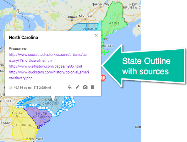
 I created this map of our town and included lines (using the
 However, when I changed the format to maps, the engagement and quality significantly improved. Students entered in the morning ASKING to do the ‘reports’. In the end, it was much more enjoyable for everyone! They still had to do the research and write a quality report.

